Transform your history classroom
ActiveHistory provides interactive simulations, self-marking quizzes, lesson plans, worksheets and multimedia activities designed by full-time history teacher Russel Tarr.
Build and deliver complete history courses with resources for classroom teaching, remote learning and independent study - from multimedia lectures to interactive games and historical simulations.
World History teaching resources for the high school classroom: lesson plans, worksheets, quizzes and simulation games for KS3, IGCSE, IB and A-Level teachers.
![]()
Google Earth is a fantastic tool which allows you to explore the globe from your home computer. You can whizz around the planet; zoom in and out of countries, towns and even streets; examine the terrain, add your own overlay maps and construct virtual "flyover" tours of selected locations.
Google Earth has obvious applications in the Geography classroom, but it also has incredible potential for Historians.
1. Three ways that Google Earth can enhance history
All of the following, along with dozens of other examples, can be downloaded directly from https://www.activehistory.co.uk/google-earth (currently containing 124 resources, many more to follow this week!)
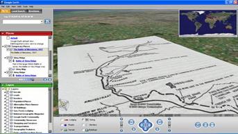
a. Terrain / Overlays"Overlays" are maps which are scanned from a computer (or taken direct from the web) and then dropped over a historical site to give a much better sense of "place"; in addition, they can appear to physically "lie" over the landscape they describe, which is fantastic for sites where terrain made a difference (e.g. Vimy Ridge). |
 |
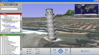
b. 3d ModelsA number of users have designed their own 3D models which you can "whizz" around from various angles. So far they are quite gimmicky, but they show what the software is capable of. |
 |
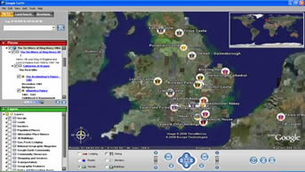
c. ToursFlyovers are fantastic - a series of placemarks which can be arranged chronologically or thematically and then Google Earth "flies" from one spot to another. The first two examples here are good illustrations of the chronological approach; the third is a thematically-based one which could easily be adapted to other subjects. |
 |
2. Obtaining existing resources - weblinks
In the first instance, it is a good idea to locate some resources to play around with that have been created already. The two sites I am using to build up my own searchable database are:
▪
Google Earth "History Illustrated" community
http://bbs.keyhole.com/ubb/postlist.php/Ca...rd/EarthHistory
▪ Google Earth Hacks: Historical Placemarks
http://www.googleearthhacks.com/dlcat40/Si...-Placemarks.htm
3. Creating your own resources - weblinks
| ▪ Sketchup: 3D Model Creator This freeware application allows you to create 3D models for Google Earth. http://sketchup.google.com/ ▪ Tagzania: Networked placemarks Sign up to this website to create collaborative tours with your students. http://www.tagzania.com/ ▪ FlickrMap: Geotagged photographs GeoTag your photos so that they appear as placemarks in Google Earth. http://www.flickrmap.com/ |
 |
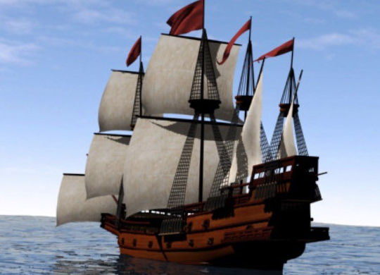
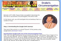
4. A Classroom Case Study: Circumnavigation of Francis Drake
▪ Available from ActiveHistory here. TIP: The final worksheet in the series contains a Google Earth Helpsheet with advice on how to add placemarks and create "flyover" tours! |
 |
5. The ActiveHistory Google Earth Database
200 or so resources, fully searchable by year group, topic and resource type: click here!

© 1998-2026 Russel Tarr, ActiveHistory.co.uk Limited (Reg. 6111680)
1 Torrin Drive, Shrewsbury, Shropshire, SY3 6AW, England
Privacy Policy | Contact